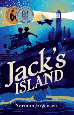
Jack’s Island
Jack’s Island
Norman Jorgensen
Fremantle Press, 2024
224pp., pbk., RRP $A17.99
9781760992958
World War II, and following the bombings of Darwin, Broome and Onslow, the threat of a Japanese invasion of Western Australia looms large. Jack’s father, with his specialist skills in road-making, is one of many required to go to Rottnest Island to construct an aerodrome as a first line of defence should Perth be attacked.
As the local ferry Valkyrie hits turbulent seas on the journey there, with all but Jack hanging over the side in dire straits, it does not presage well for this to be a smooth period in young Jack’s life, and as he himself says, “I’m not that bad – I just get caught a lot.” Jack soon teams up with Andrew “Banjo” Paterson and together, they find themselves in all sorts of strife as they just do the things that boys of that age in that era did – being in school where corporal punishment at the hands of stern schoolmasters was the norm, building billy carts and canoes, being where they shouldn’t because they are fascinated by what’s going on around them, climbing cliffs and trees with the inevitable consequences….
But as much as this story is about the derring-do of lads who find reserves of courage and resourcefulness they didn’t know they had, it is a story of friendship and loyalty and the acceptance of people for who they are as they are that only seems to happen amongst children. This is particularly true when it comes to protecting the intellectually-challenged Dafty, and when he is lost overboard at sea, the boys are devastated.
Norman Jorgensen has delved deep into his family’s past, particularly his father’s adventures on Rottnest during the war, and from this has created something unique – a story that shines a light on a past time when life was much more carefree in some ways, but also so much more restricted in others, not the least being the continuing prejudice towards those who are different in any way as well as rationing, conscription, and the threat of invasion hanging overhead especially when the boys find the helmet and rifle of a Japanese soldier at the base of a cliff. But for all that, there are times when it is LOL funny, and tear-in-your-eye serious, with endearing characters that took me back to my own childhood in post-war years when we roamed our local shoreline freely told to return only “when the tide turned or it got dark”.
When this was first released, it won the WA Young Readers’ Book Award 2009 and was a CBCA Notable for that year, awards that were thoroughly deserved. Now, re-released in a new livery, it remains an excellent read, one that will entertain and engage a new generation, including all those young lads who will see themselves in Jack and Banjo.
To add an essential extra to the read, complete with actual photos of the time, be sure to watch and share this remarkable book trailer